Impact of Spatial Scale on Optical Earth Observation-Derived Seasonal Surface Water Extents
Abstract
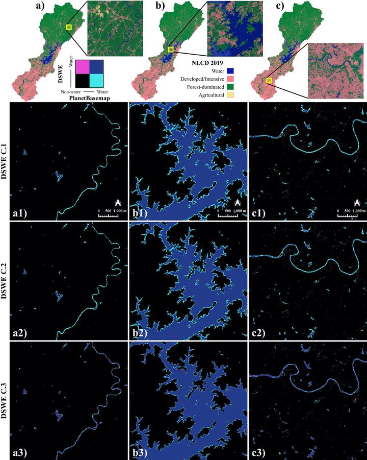
Landsat-derived products are the most prominent, publicly available sources of large-scale surface water extent data. However, few studies have assessed the limitations of spatial scale on such products. Here, we mapped seasonal surface water extents utilizing high-resolution (4.77 m) PlanetScope Basemap imagery and machine learning. We conducted a pixel-wise comparison of these high resolution classifications with a set of classifications from a moderate resolution (30 m) Landsat product. The vast majority (93%) of areas classified as water by the Landsat product were similarly classified by PlanetBasemap; however, only 65%–75% of the PlanetBasemap water area was also classified by the Landsat classes. Of the Landsat classes, only the partial surface water class comparably detects smaller water bodies (widths 50–70 m) with PlanetBasemaps. Our results indicate that higher resolution imagery detects more small water bodies, which are instrumental to better understanding flood dynamics, methane emissions, and downstream water volume and quality.
Mollie D. Gaines
Postdoctoral Research Scholar
I am a Postdoctoral Research Scholar in the Department of Forestry and Environmental Resources at North Carolina State University.
Mirela G. Tulbure
Professor
I am a Professor with the Center for Geospatial Analytics at North Carolina State University (NCSU).
Vini Perin
PhD Student
My research interests include surface water, agriculture, irrigation, remote sensing and hydrological modeling.
Darcy Boast
She/Her/Hers
Undergraduate Researcher
I am an undergraduate student majoring in Environmental Sciences at North Carolina State University.
Rebecca Composto
PhD Candidate
I am a PhD student with the Center for Geospatial Analytics at North Carolina State University.
Júlio Caineta
Postdoctoral Research Scholar
I am a Postdoctoral Research Scholar with the Center for Geospatial Analytics website at North Carolina State University (NCSU).