GAEC Lab
GAEC Lab
People
News
Projects
Publications
Posters
Opportunities
Blogs
Light
Dark
Automatic
Publications and Presentations
Type
Uncategorized
Conference paper
Journal article
Report
Date
2024
2022
2021
2020
2019
2018
2017
2016
2015
2014
2013
2012
2011
2010
2009
2008
2005
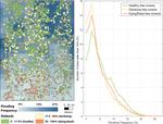
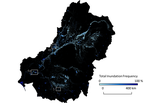
Quantifying urban flood extent using satellite imagery and machine learning
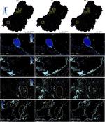
The risk of floods from tropical storms is increasing due to climate change and human development. Maps of past flood extents can aid …
Rebecca Composto
,
Mirela G. Tulbure
,
Varun Tiwari
,
Mollie D. Gaines
,
Júlio Caineta
PDF
Cite
DOI
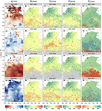
Projecting Surface Water Area Under Different Climate and Development Scenarios
Changes in climate and land-use/land-cover will impact surface water dynamics throughout the 21st century and influence global surface …
Mollie D. Gaines
,
Mirela G. Tulbure
,
Vini Perin
,
Rebecca Composto
,
Varun Tiwari
PDF
Cite
Project
DOI
Automated in-season rice crop mapping using Sentinel time-series data and Google Earth Engine: A case study in climate-risk prone Bangladesh
We developed a novel framework to map boro rice at peak season using Sentinel images. These Boro rice maps in Bangladesh showed high classification accuracy (mean of 87.90%). There was no requirement of sample data collection for training the classification model. Multi-Otsu effectively maps rice in low-data areas, outperforming other ML methods and provides stakeholders rice area statistics to support food security management.
Varun Tiwari
,
Mirela G. Tulbure
,
Júlio Caineta
,
Mollie D. Gaines
,
Vini Perin
,
Mustafa Kamal
,
Timothy J. Krupnik
,
Md Abdullah Aziz
,
AFM Tariqul Islam
PDF
Cite
DOI
Performance Evaluation of Google Earth Engine Based Precipitation Datasets Under Different Climatic Zones over India
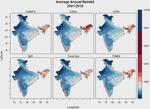
Satellite as well as reanalysis-based datasets are widely available and useful in detecting spatial and temporal variability of …
Sukant Jain
,
Varun Tiwari
,
Amrit Thapa
,
Rohit Mangla
,
R. K. Jaiswal
,
Vinay Kumar
,
Supriya Tiwari
,
Mirela G. Tulbure
,
Ravi Galkate
,
A. K. Lohani
,
Kamal Pandey
PDF
Cite
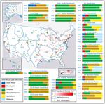
Effects of Climate and Anthropogenic Drivers on Surface Water Area in the Southeastern United States
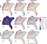
People and the environment rely on water to exist and thrive, especially water on the Earth’s surface because that is the easiest place to get it. The amount of surface water and where it is located is changing with the climate and changes in people’s water use, and our need for it is increasing. To plan ahead for future water needs, we need to better understand how the climate and people are changing surface water patterns both separately and together. To help improve our understanding of these changes, we modeled the amount of surface water in three different ways. First, we modeled based on climate data (like temperature and precipitation); second, based on human data (like land use and population); and third, based on both climate and human data together. We found that we could best model the amount of surface water if we used both climate and human data together, and that human data can explain a lot of the changes in the amount of surface water. These results mean that we can work to control changes in the amount of surface water by controlling human actions through planning and policies.
Mollie D. Gaines
,
Mirela G. Tulbure
,
Vini Perin
PDF
Cite
Project
Forest water use is increasingly decoupled from water availability even during severe drought
Key to understanding forest water balances is the role of tree species regulating evapotranspiration (ET), but the synergistic impact …
Katie A. McQuillan
,
Mirela G. Tulbure
,
Katherine L. Martin
PDF
Cite
Can we detect more ephemeral floods with higher density harmonized Landsat Sentinel 2 data compared to Landsat 8 alone?
Spatiotemporal quantification of surface water and flooding is essential given that floods are among the largest natural hazards. …
Mirela G. Tulbure
,
Mark Broich
,
Vini Perin
,
Mollie D. Gaines
,
Junchang Ju
,
Stephen V. Stehman
,
Tamlin Pavelsky
,
Jeffrey G. Masek
,
Simon Yin
,
Joachim Mai
,
Luc Betbeder-Matibet
PDF
Cite
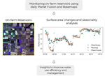
A multi-sensor satellite imagery approach to monitor on-farm reservoirs
Fresh water stored by on-farm reservoirs (OFRs) is an important component of surface hydrology and is critical for meeting global …
Vini Perin
,
Mirela G. Tulbure
,
Mollie D. Gaines
,
Michele L. Reba
,
Mary A. Yaeger
PDF
Cite
Project
Regional matters: On the usefulness of regional land-cover datasets in times of global change
Unprecedented amounts of analysis-ready Earth Observation (EO) data, combined with increasing computational power and new algorithms, …
Mirela G. Tulbure
,
Patrick Hostert
,
Tobias Kuemmerle
,
Mark Broich
PDF
Cite
Project
DOI
Monitoring Small Water Bodies Using High Spatial and Temporal Resolution Analysis Ready Datasets
Basemap and Planet Fusion—derived from PlanetScope imagery—represent the next generation of analysis ready datasets that minimize the …
Vini Perin
,
Samapriya Roy
,
Joe Kington
,
Thomas Harris
,
Mirela G. Tulbure
,
Noah Stone
,
Torben Barsballe
,
Michele Reba
,
Mary A. Yaeger
Cite
Project
DOI
Towards global flood mapping with machine learning based on the Harmonized Landsat-Sentinel 2 data
Floods are the largest natural hazard in terms of life loss and economic damage, regardless of their cause. In the United States alone, …
Mirela G. Tulbure
,
Mark Broich
,
Mollie D. Gaines
,
Stephen V. Stehman
,
Tamlin Pavelsky
,
Vinicus Perin
,
Junchang Ju
,
Simon Yin
,
Joachim Mai
,
Luc Betbeder-Matibet
PDF
Project
Leveraging the NEON Airborne Observation Platform for socio-environmental systems research
During the 21st century, human–environment interactions will increasingly expose both systems to risks, but also yield opportunities …
E. M. Ordway
,
A. J. Elmore
,
S. Kolstoe
,
J. E. Quinn
,
R. Swanwick
,
M. Cattau
,
D. Taillie
,
S. M. Guinn
,
K. D. Chadwick
,
J. W. Atkins
,
R. E. Blake
,
M. Chapman
,
K. Cobourn
,
T. Goulden
,
M. R. Helmus
,
K. Hondula
,
C. Hritz
,
J. Jensen
,
J. P. Julian
,
Y. Kuwayama
,
V. Lulla
,
D. O'Leary
,
D. R. Nelson
,
J. P. Ocón
,
S. Pau
,
G. E. Ponce-Campos
,
C. Portillo-Quintero
,
N. G. Pricope
,
R. G. Rivero
,
L. Schneider
,
M. Steele
,
Mirela G. Tulbure
,
M. A. Williamson
,
C. Wilson
PDF
Cite
DOI
Preliminary comparison and evaluation of soil moisture simulated in GFSv15 and GFSv16
Accurate estimation of land surface states is critical for improving prediction of coupled global weather and climate forecast systems, …
Youlong Xia
,
Helin Wei
,
Mollie D. Gaines
,
Jesse Meng
,
George Gayno
,
Hang Lei
,
Rongqian Yang
,
Yihua Wu
,
Fanglin Yang
,
Michael J. Barlage
,
Daryl T. Kleist
,
Vijay S. Tallapragada
PDF
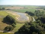
On-farm reservoir monitoring using Landsat inundation datasets
On-farm reservoirs (OFRs)—artificial water impoundments that retain water from rainfall and run-off—enable farmers to store water during the wet season to be used for crop irrigation during the dry season. However, monitoring the inter- and intra-annual change of these water bodies remains a challenging task because they are typically small (< 10 ha) and occur in high numbers. Therefore, we used two existing Landsat inundation datasets—the U.S. Geological Survey Dynamic Surface Water Extent (DSWE) and the European Commission’s Joint Research Centre (JRC) Global Monthly Water History—to assess surface water area change of OFRs located in eastern Arkansas, the third most irrigated state in the U.S.
Vini Perin
,
Mirela G. Tulbure
,
Mollie D. Gaines
,
Michele L. Reba
,
Mary A. Yaeger
PDF
Cite
Project
The Effects of Climate and Human Drivers on Changes in Surface Water in the Southeastern United States
Water stress is a global concern as a changing climate leads to variations in weather patterns and agricultural and urban areas continue to use water-intensive practices. Understanding spatial and temporal factors of surface water dynamics is key to better managing our resources and limiting the effects of water stress
Mollie D. Gaines
,
Mirela G. Tulbure
,
Vini Perin
Project
AGU Link
Can we detect more ephemeral floods with higher density harmonized Landsat 8/Sentinel 2 data compared to just one sensor?
Floods, defined as water that temporarily submerges land for over 72 hours or longer, are the largest natural hazard in terms of life loss and economic damage. Effective and immediate disaster response management can reduce the impact of floods but it requires near real-time information on flood occurrence, typically derived based on Earth Observation data.
Mirela G. Tulbure
,
Mark Broich
,
Junchang Ju
,
Vini Perin
,
Mollie D. Gaines
,
Simon Yin
,
Stephen V. Stehman
,
Tamlin Pavelsky
,
Joachim Mai
,
Luc Betbeder-Matibet
,
Jeffrey G Masek
AGU Link
A Review of Geospatial Content in IEEE Visualization Publications
Geospatial analysis is crucial for addressing many of the world’s most pressing challenges. In this work, we explore this important intersection – between geospatial analytics and visualization – by examining a set of recent IEEE VIS Conference papers (a selection from 2017-2019) to assess the inclusion of geospatial data and geospatial analyses within these papers.
Mollie D. Gaines
,
Vini Perin
Cite
DOI
PDF
Understanding the Importance of Dynamic Landscape Connectivity
Landscape connectivity is increasingly promoted as a conservation tool to combat the negative effects of habitat loss, fragmentation, …
Katherine A. Zeller
,
Rebecca Lewison
,
Robert J. Fletcher
,
Mirela G. Tulbure
,
Megan K. Jennings
PDF
Cite
DOI
The role of GRACE total water storage anomalies, streamflow and rainfall in stream salinity trends across Australia’s Murray-Darling Basin during and post the Millennium Drought
By influencing water tables of saline aquifers, multiyear dry or wet periods can significantly delay or accelerate dryland salinity, but this effect remains poorly quantified at the large river basin scale.
Valentin Heimhuber
,
Mirela G. Tulbure
,
Mark Broich
PDF
Cite
Project
Surface water and flooding dynamics data set based on seasonally continuous Landsat data (1986-2011) in a dryland river basin
The layers provided here are part of the publication,
[Tulbure, M.G. and M. Broich (2018)]
. The method is described in
[Tulbure et al. …
Mirela G. Tulbure
,
Mark Broich
Cite
Dataset Link
Surface water and flooding dynamics based on seasonally continuous Landsat data (1986-2011) in a dryland river basin (monthly, seasonally, and yearly animations)
The animations provided here are part of the publication,
[Tulbure, M.G. and M. Broich (2018)]
. The method is described in
[Tulbure et …
Mirela G. Tulbure
,
Mark Broich
Cite
Dataset Link
Multi-sensor airborne and satellite data for upscaling tree number information in a structurally complex eucalypt forest
Detailed information on the number and density of trees is important for conservation and sustainable use of forest resources. In this respect, remote sensing technology is a reliable tool for deriving timely and fine-scale information on forest inventory attributes. However, to better predict and understand the functioning of the forest, fine-scale measures of tree number and density must be extrapolated to the forest plot or stand levels through upscaling.
Yuri Shendryk
,
Mark Broich
,
Mirela G. Tulbure
PDF
Cite
Spatiotemporal patterns and effects of climate and land use on surface water extent dynamics in a dryland region with three decades of Landsat satellite data
Spatiotemporal distribution and systematic quantification of surface water and their drivers of change are critical. However, quantifying this distribution is challenging due to a lack of spatially explicit and temporally dynamic empirical data of both surface water and its drivers of change at large spatial scales.
Mirela G. Tulbure
,
Mark Broich
PDF
Cite
Quantifying Australia's dryland vegetation response to flooding and drought at sub-continental scale
Vegetation response to flooding across large dryland areas such as Australia’s Murray Darling Basin (MDB) is not understood synoptically and with locally relevant detail.
Mirela G. Tulbure
,
Mark Broich
,
Jan Verbesselt
,
Qinchuan Xin
,
Jack Wearne
PDF
Cite
Addressing spatio-temporal resolution constraints in Landsat and MODIS-based mapping of large-scale floodplain inundation dynamics
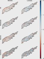
Recent studies have developed novel long-term records of surface water (SW) maps on continental and global scales but due to the spatial and temporal resolution constraints of available satellite sensors, they are either of high spatial and low temporal resolution or vice versa.
Valentin Heimhuber
,
Mirela G. Tulbure
,
Mark Broich
PDF
Cite
In-season wheat sown area mapping for Afghanistan using high resolution optical and RADAR images in cloud platform
Afghanistan has only 11% of arable land while wheat is the major crop with 80% of total cereal planted area. The production of wheat is …
M. A. Matin
,
Varun Tiwari
,
F. M. Qamer
,
N. K. Yadav
,
W. :. Ellenburg
,
B. Bajracharya
,
K. Vadrevu
,
B. R. Rushi
,
N. Stanikzai
,
W. Yusafi
,
H. Rahmani
PDF
Impact of hydroclimatic variability on regional-scale landscape connectivity across a dynamic dryland region
In dynamic dryland regions, accounting for spatiotemporal landscape dynamics is essential to understanding how ecological habitat networks are affected by hydroclimatic variability at regional or sub-continental scales. Here we assess how changes in the distribution and availability of surface water influence potential landscape connectivity for water-dependent organisms by combining graph theory network analysis with a Landsat-derived, seasonally continuous 25-year surface-water time-series.
Robbi Bishop-Taylor
,
Mirela G. Tulbure
,
Mark Broich
PDF
Cite
Evaluating static and dynamic landscape connectivity modelling using a 25-year remote sensing time series
Despite calls for landscape connectivity research to account for spatiotemporal dynamics, studies have overwhelmingly evaluated the importance of habitats for connectivity at single or limited moments in time. Remote sensing time series represent a promising resource for studying connectivity within dynamic ecosystems. However, there is a critical need to assess how static and dynamic landscape connectivity modelling approaches compare for prioritising habitats for conservation within dynamic environments.
Robbi Bishop-Taylor
,
Mirela G. Tulbure
,
Mark Broich
PDF
Cite
Project
Surface water network structure, landscape resistance to movement and flooding vital for maintaining ecological connectivity across Australia’s largest river basin
Landscape-scale research quantifying ecological connectivity is required to maintain the viability of populations in dynamic …
Robbi Bishop-Taylor
,
Mirela G. Tulbure
,
Mark Broich
PDF
Cite
Project
DOI
Surface-water dynamics and land use influence landscape connectivity across a major dryland region
Landscape connectivity is important for the long-term persistence of species inhabiting dryland freshwater ecosystems, with spatiotemporal surface-water dynamics (e.g., flooding) maintaining connectivity by both creating temporary habitats and providing transient opportunities for dispersal.
Robbi Bishop-Taylor
,
Mirela G. Tulbure
,
Mark Broich
PDF
Cite
Project
Modeling multidecadal surface water inundation dynamics and key drivers on large river basin scale using multiple time series of Earth-observation and river flow data
Periodically inundated floodplain areas are hot spots of biodiversity and provide a broad range of ecosystem services but have suffered alarming declines in recent history. Despite their importance, their long-term surface water (SW) dynamics and hydroclimatic drivers remain poorly quantified on continental scales.
Valentin Heimhuber
,
Mirela G. Tulbure
,
Mark Broich
PDF
Cite
Project
Drought resistance across California ecosystems: evaluating changes in carbon dynamics using satellite imagery
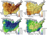
Drought is a global issue that is exacerbated by climate change and increasing anthropogenic water demands. The recent occurrence of drought in California provides an important opportunity to examine drought response across ecosystem classes (forests, shrublands, grasslands, and wetlands), which is essential to understand how climate influences ecosystem structure and function.
Sparkle L. Malone
,
Mirela G. Tulbure
,
Antonio J. Pérez-Luque
,
Timothy J. Assal
,
Leah L. Bremer
,
Debora P. Drucker
,
Vicken Hillis
,
Sara Varela
,
Michael L. Goulden
PDF
Cite
Big data opportunities and challenges for assessing multiple stressors across scales in aquatic ecosystems
Aquatic ecosystems are under threat from multiple stressors, which vary in distribution and intensity across temporal and spatial scales. Monitoring and assessment of these ecosystems have historically focussed on collection of physical and chemical information and increasingly include associated observations on biological condition
K. A. Dafforn
,
E. L. Johnston
,
A. Ferguson
,
C.L. Humphrey
,
W. Monk
,
S. J. Nichols
,
S. L. Simpson G
,
Mirela G. Tulbure
,
D. J. Baird
PDF
Mapping individual tree health using full-waveform airborne laser scans and imaging spectroscopy: A case study for a floodplain eucalypt forest
Declining forest health can affect crucial ecosystem functions, such as carbon storage in biomass and soils, the regulation of water regimes, the modulation of regional climate and conservation of biodiversity. Airborne laser scanning (ALS) and imaging spectroscopy (IS) are two potentially complementary remote sensing technologies capable of characterizing and monitoring regional forest health.
Yuri Shendryk
,
Mark Broich
,
Mirela G. Tulbure
,
Andrew McGrath
,
David Keith
,
Sergey V.Alexandrove
PDF
Cite
Modeling 25 years of spatio-temporal surface water and inundation dynamics on large river basin scale using time series of Earth observation data
The usage of time series of Earth observation (EO) data for analyzing and modeling surface water extent (SWE) dynamics across broad geographic regions provides important information for sustainable management and restoration of terrestrial surface water resources, which suffered alarming declines and deterioration globally.
Valentin Heimhuber
,
Mirela G. Tulbure
,
Mark Broich
PDF
Cite
Project
Bottom-up delineation of individual trees from full-waveform airborne laser scans in a structurally complex eucalypt forest
Full-waveform airborne laser scanning (ALS) is a powerful tool for characterizing and monitoring forest structure over large areas at the individual tree level. Most of the existing ALS-based algorithms for individual tree delineation from the point cloud are top-down, which are accurate for delineating cone-shaped conifers, but have lower delineation accuracies over more structurally complex broad-leaf forests.
Yuri Shendryk
,
Mark Broich
,
Mirela G. Tulbure
,
Sergey V.Alexandrov
PDF
Cite
DOI
Surface water extent dynamics from three decades of seasonally continuous Landsat time series at subcontinental scale in a semi-arid region
Seasonally continuous long-term information on surface water and flooding extent over subcontinental scales is critical for quantifying spatiotemporal changes in surface water dynamics. We used seasonally continuous Landsat TM/ETM + data and generic random forest-based models to synoptically map the extent and dynamics of surface water and flooding (1986–2011) over the Murray–Darling Basin (MDB).
Mirela G. Tulbure
,
Mark Broich
,
Stephen V.Stehman
,
Anil Kommareddyc
PDF
Cite
Project
Project
DOI
Simulation of the Hyperspectral Data from Multispectral Data Using Open Source Programming Environment
Multispectral remote sensing (MSS) sensors have been generally utilized for acquiring and extracting information of Land Use Land …
Varun Tiwari
,
Vinary Kumar
,
Rigved Ranade
,
Kamal Pandey
,
Shefali Agrawal
PDF
Cite
A spatially explicit land surface phenology data product for science, monitoring and natural resources management applications
Land surface phenology (LSP) characterizes episodes of greening and browning of the vegetated land surface from remote sensing imagery. …
Mark Broich
,
Alfredo Huete
,
Matt Paget
,
Xuanlong Ma
,
Mirela G. Tulbure
,
Natalia Restrepo Coupe
,
Bradley Evans
,
Jason Beringer
,
Rakhesh Devadas
,
Kevin Davies
,
Alex Held
PDF
Cite
DOI
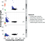
Spatiotemporal dynamics of surface water networks across a global biodiversity hotspot—implications for conservation
The concept of habitat networks represents an important tool for landscape conservation and management at regional scales. Previous studies simulated degradation of temporally fixed networks but few quantified the change in network connectivity from disintegration of key features that undergo naturally occurring spatiotemporal dynamics.
Mirela G. Tulbure
,
Stuart Kininmonth
,
Mark Broich
PDF
Cite
DOI
Data from: Spatiotemporal dynamic of surface water bodies using Landsat time-series data from 1999 to 2011
Detailed information on the spatiotemporal dynamic in surface water bodies is important for quantifying the effects of a drying …
Mirela G. Tulbure
,
Mark Broich
Dataset
Project
DOI
Land surface phenological response to decadal climate variability across Australia using satellite remote sensing
Land surface phenological cycles of vegetation greening and browning are influenced by variability in climatic forcing. Quantitative …
Mark Broich
,
Alfredo Huete
,
Mirela G. Tulbure
,
Xuanlong Ma
,
Qinchuan Xin
,
Matt Paget
,
Natalia Restrepo Coupe
,
Rakhesh Devadas
,
Kevin Davies
,
Alex Held
PDF
Cite
DOI
Spatial patterns and temporal dynamics in savanna vegetation phenology across the North Australian Tropical Transect
The phenology of a landscape is a key parameter in climate and biogeochemical cycle models and its correct representation is central to …
X. Ma
,
A. Huete
,
Q. Yu
,
N. R. Coupe
,
K. Davies
,
Mark Broich
,
P. Ratana
,
J. Beringer
,
L. B. Hutley
,
J. Cleverly
,
N. Boulain
,
D. Eamus
PDF
Cite
DOI
A Production Efficiency Model-Based Method for Satellite Estimates of Corn and Soybean Yields in the Midwestern US
Remote sensing techniques that provide synoptic and repetitive observations over large geographic areas have become increasingly …
Q. Xin
,
P. Gong
,
C. Yu
,
L. Yu
,
Mark Broich
,
A. E. Suyker
,
R. B. Myneni
PDF
Cite
DOI
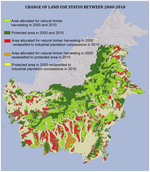
Reconciling Forest Conservation and Logging in Indonesian Borneo
Combining protected areas with natural forest timber concessions may sustain larger forest landscapes than is possible via protected …
David L. A. Gaveau
,
Mrigesh Kshatriya
,
Douglass Sheil
,
Sean Sloan
,
Elis Molidena
,
Arief Wijaya
,
Serge Wich
,
Marc Ancrenaz
,
Matthew Hansen
,
Mark Broich
,
Manuel R. Guariguata
,
Pablo Pacheco
,
Peter Potapov
,
Svetlana Turubanova
,
Erik Meijaard
PDF
Cite
DOI
Patterns of tree-cover loss along the Indonesia–Malaysia border on Borneo
Borneo Island is experiencing rapid tree-cover loss. This loss has been quantified for the Indonesian part of the island at Landsat …
Mark Broich
,
M. Hansen
,
P. Potapov
,
M. Wimberly
PDF
Cite
DOI
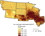
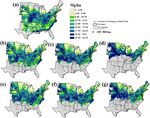
Interannual variability of crop residue potential in the north central region of the United States
Crop residue is potentially a major biomass feedstock for bio-based industries. Spatial and interannual variability of crop residue …
R. Chintala
,
M. C. Wimberly
,
G. D. Djira
,
Mirela G. Tulbure
PDF
Cite
DOI
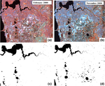
Spatiotemporal dynamic of surface water bodies using Landsat time-series data from 1999 to 2011
Detailed information on the spatiotemporal dynamic in surface water bodies is important for quantifying the effects of a drying climate, increased water abstraction and rapid urbanization on wetlands.
Mirela G. Tulbure
,
Mark Broich
PDF
Cite
Project
Response of switchgrass yield to future climate change
A climate envelope approach was used to model the response of switchgrass, a model bioenergy species in the United States, to future …
Mirela G. Tulbure
,
Michael C. Wimberly
,
Vance N. Owens
PDF
Cite
DOI
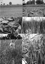
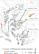
Inventory and Ventilation Efficiency of Nonnative and Native *Phragmites australis* (Common Reed) in Tidal Wetlands of the Chesapeake Bay
Nonnative Phragmites is among the most invasive plants in the U.S. Atlantic coast tidal wetlands, whereas the native Phragmites has …
Mirela G. Tulbure
,
D. M. Ghioca-Robrecht
,
C. A. Johnston
,
D. F. Whigham
PDF
Cite
DOI
Quantifying forest cover loss in Democratic Republic of the Congo, 2000–2010, with Landsat ETM + data
Forest cover and forest cover loss for the last decade, 2000–2010, have been quantified for the Democratic Republic of the Congo (DRC) …
Peter V. Potapov
,
Svetlana A. Turubanova
,
Matthew C. Hansen
,
Bernard Adusei
,
Mark Broich
,
Alice Altstatt
,
Landing Mane
,
Christopher O. Justice
PDF
Cite
DOI
Climatic and genetic controls of yields of switchgrass, a model bioenergy species
The U.S. Renewable Fuel Standard calls for 136 billion liters of renewable fuels production by 2022. Switchgrass (Panicum virgatum L.) …
Mirela G. Tulbure
,
Michael C. Wimberly
,
Arvid Boe
,
Vance N. Owens
PDF
Cite
DOI
A report for Fire and Emergency Services, Bushfire Protection Branch
Bushfire threat analysis (BFTA) is an assessment of the comparative risk of damage resulting from bushfires in Western Australia …
Mark Broich
,
Joe Fontaine
,
Mirela G. Tulbure
PDF
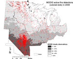
Spatial and temporal heterogeneity of agricultural fires in the central United States in relation to land cover and land use
Agricultural burning is an important land use practice in the central U.S. but has received little attention in the literature, whereas …
Mirela G. Tulbure
,
Michael C. Wimberly
,
David P. Roy
,
Geoffrey M. Henebry
PDF
Cite
DOI
Remotely sensed forest cover loss shows high spatial and temporal variation across Sumatera and Kalimantan, Indonesia 2000–2008
The Indonesian islands of Sumatera and Kalimantan (the Indonesian part of the island of Borneo) are a center of significant and rapid …
Mark Broich
,
M. Hansen
,
F. Stolle
,
P. Potapov
,
B. A. Margono
,
B. Adusei
PDF
Cite
DOI
Adapting a global stratified random sample for regional estimation of forest cover change derived from satellite imagery
A desirable feature of a global sampling design for estimating forest cover change based on satellite imagery is the ability to adapt …
S. V. Stehman
,
M. C. Hansen
,
Mark Broich
,
P. V. Potapov
PDF
Cite
DOI
Time-series analysis of multi-resolution optical imagery for quantifying forest cover loss in Sumatra and Kalimantan, Indonesia
Monitoring loss of humid tropical forests via remotely sensed imagery is critical for a number of environmental monitoring objectives, …
Mark Broich
,
Matthew C. Hansen
,
Peter Potapov
,
Bernard Adusei
,
Erik Lindquist
,
Stephen Stehman
PDF
Cite
DOI
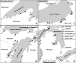
Latitudinal gradient of floristic condition among Great Lakes coastal wetlands
Coastal wetland vegetation along the Great Lakes differs strongly with latitude, but most studies of Great Lakes wetland condition have attempted to exclude the effect of latitude to discern anthropogenic effects on condition. This approach provides a means to identify wetlands worthy of preservation, to establish vegetation targets for wetland restoration, and to forecast changes in floristic quality associated with future climate change.
C. Johnston
,
J. B. Zedler
,
Mirela G. Tulbure
PDF
Cite
DOI
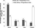
Environmental Conditions Promoting Non-native Phragmites australis Expansion in Great Lakes Coastal Wetlands
The invasion and expansion of the non-native Phragmites australis in Great Lakes coastal wetlands is of increasing concern. Monitoring coastal wetlands where water level has dropped and controlling Phragmites at early stages of invasion are essential for maintaining healthy Great Lakes coastal wetlands of high species diversity and wildlife habitat. This becomes important as water levels in the Great Lakes have reached extreme lows and are expected to decline with future climate change.
Mirela G. Tulbure
,
C. Johnston
PDF
Cite
Prairie Wetland Complexes as Landscape Functional Units in a Changing Climate
The wetland complex is the functional ecological unit of the prairie pothole region (PPR) of central North America. Maintaining ecosystem goods and services at current levels in a warmer climate will be a major challenge for the conservation community.
W. C. Johnson
,
B. Werner
,
G. R. Guntenspergen
,
R. A. Voldseth
,
B. Millett
,
D. E. Naugle
,
Mirela G. Tulbure
,
R. W. H. Carroll
,
J. Tracy
,
C. Olawsky
PDF
Cite
A unifying approach for evaluating the condition of wetland plant communities and identifying related stressors
Assessment of vegetation is an important part of evaluating wetland condition, but it is complicated by the variety of plant communities that are naturally present in freshwater wetlands. Our findings provide a means of using vegetation to evaluate a range of wetland condition across a broad and diverse geographic region.
C. Johnston
,
J. B. Zedler
,
Mirela G. Tulbure
,
C. Frieswyk
,
B. L. Bedford
,
L. Vaccaro
PDF
Cite
DOI
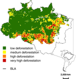
A comparison of sampling designs for estimating deforestation from Landsatimagery: A case study of the Brazilian Legal Amazon
Three sampling designs —simple random, stratified random, and systematic sampling —are compared onthe basis of precision of estimated loss of intact humid tropical forest area in the Brazilian Legal Amazon from 2000 to 2005. The results of this case study demonstrate the utility of a stratified design based on MODIS-derived deforestationdata to improve precision of the estimated loss of intact forest area as estimated from sampling Landsat imagery.
Mark Broich
,
S. Stehman
,
M. Hansen
,
P. Potapov
,
Y. E. Shimabukuro
PDF
Cite
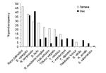
Rapid Invasion of a Great Lakes Coastal Wetland by Non-native Phragmites australis and Typha
Great Lakes coastal wetlands are subject to water level fluctuations that promote the maintenance of coastal wetlands. Point au Sauble, …
Mirela G. Tulbure
,
C. Johnston
,
D. Auger
Cite
PDF
Assessing the use of multiseason QuickBird imagery for mapping invasive species in a Lake Erie coastal Marsh
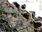
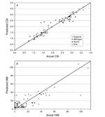
QuickBird multispectral satellite images taken in September 2002 (peak biomass) and April2003 (pre-growing season) were used to map emergent wetland vegetation communities, particularlyinvasive Phragmites australis and Typha spp., within a diked wetland at the western end of Lake Erie. Multiseason QuickBird imagery is promising fordistinguishing certain wetland plant species, but should be used with caution in highly managed areaswhere vegetation changes may reflect human alterations rather than phenological change.
Mirela G. Tulbure
,
D. Ghioca-Robrecht
,
C. Johnston
PDF
Cite
Plant Species Indicators of Physical Environment in Great Lakes Coastal Wetlands
Plant taxa identified in 90 U.S. Great Lakes coastal emergent wetlands were evaluated as indicators of physical environment. A fuller understanding of how the physical environment influences plant species distribution will improve our ability to detect the response of wetland vegetation to anthropogenic activities.
C. Johnston
,
B. L Bedford
,
M. Bourdaghs
,
T. Brown
,
C. Frieswyk
,
Mirela G. Tulbure
,
L. Vaccaro
,
J. B. Zedler
PDF
Cite
DOI
Partitioning Vegetation Response to Anthropogenic Stress to Develop Multi-Taxa Wetland Indicators
Emergent plants can be suitable indicators of anthropogenic stress in coastal wetlands if their responses to natural environmental …
Mirela G. Tulbure
,
C. Johnston
,
D. Ghioca-Robrecht
,
B. L. Bedford
,
M. Bourdaghs
,
C. B. Frieswyk
,
L. Vaccaro
,
J. B. Zedler
PDF
Cite
DOI
The influence of habitat characteristics on amphibian species richness in two river basins of Romania
We present the distribution and aquatic habitat use of amphibian communities in two river basins of Transylvania (Romania) on a medium …
Tibor Hartel
,
Laszlo Demeter
,
Dan Cogalniceanu
,
Mirela G. Tulbure
Cite
PDF
Cite
×