Water Resources in a Changing Climate
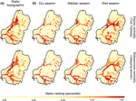
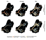
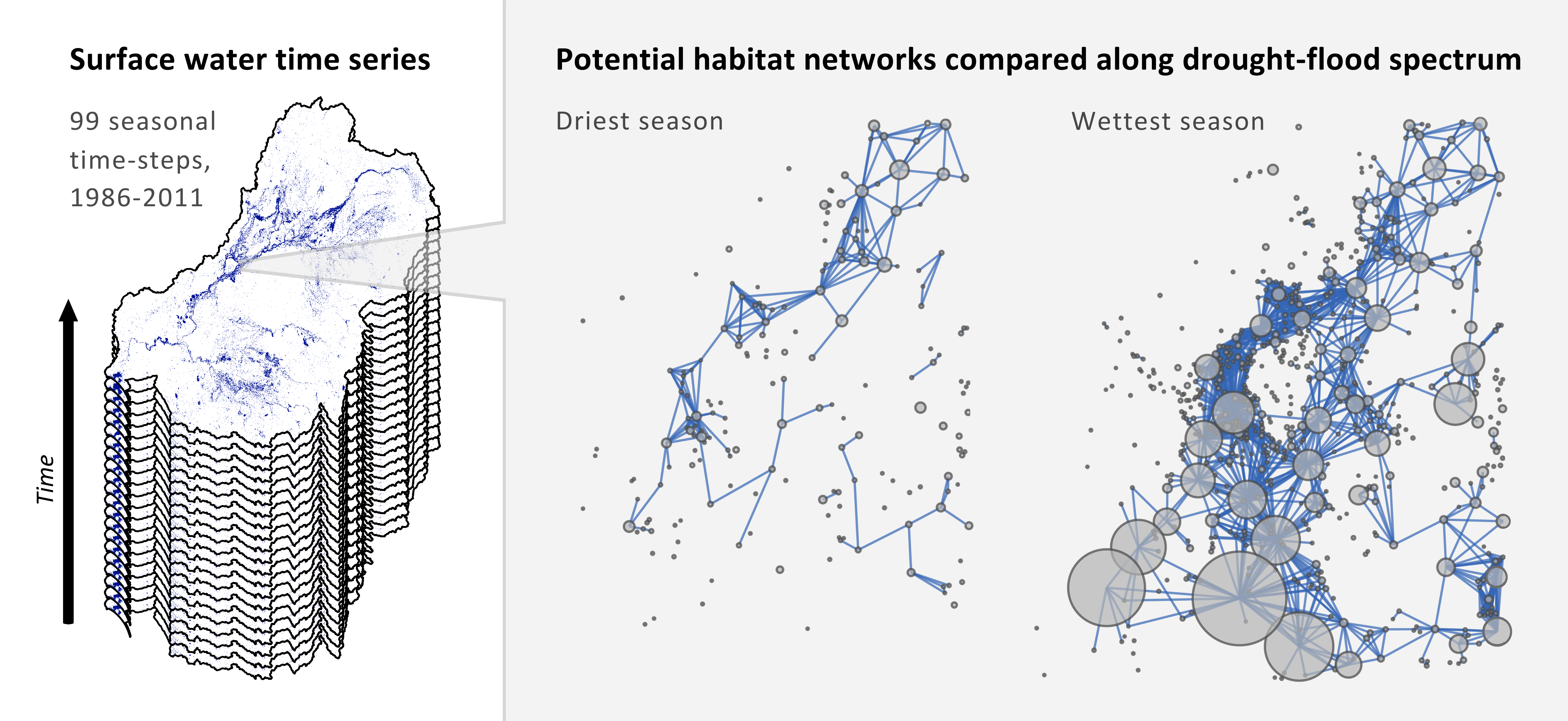
 Figure 3 from Bishop-Taylor et al. 2017 “Distribution of top 1% stepping-stones and hubs across the MDB. Important habitats are shown separately for two dispersal abilities (short-distance, ~1000 m; long-distance, ~ 5000 m) and the driest 25%, average (25–75%) and the wettest 25% of seasons by inundated habitat area.”
Climate and land use change act synergistically to affect scarce water resources, already under enormous pressure in Australia. This cross-disciplinary project aimed to quantify the climate-driven variability and impact of climate and land use change on surface water dynamics and connectivity. This research took a holistic approach integrating remote sensing and climate data, land use science, graph theory, and spatial statistics. The project focused on one of largest dryland basins in the world (the size of the four corner states), Australia’s Murray-Darling Basin (MDB).
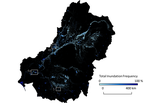
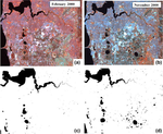
 We first derived time series of surface water habitats using Landsat time series from 1996-2018 (Tulbure et al. 2016). We creatively used the time series of surface water habitats derived above together with graph theory network analysis and circuit theory to simulate what the resistance to movement between water habitats is, given the land use between them in addition to distance (Bishop-Taylor et al. 2015). This work showed that surface water areas important for connectivity exhibited extreme variability over time in the MDB (Bishop-Taylor et al. 2017), but were predominantly located within protected areas and that water network structure provided a degree of resilience to drought (Bishop-Taylor et al. 2018). We also showed that by not incorporating habitat dynamics data derived from remotely sensed time series in connectivity analysis but by modeling landscape connectivity at single or limited snapshots in time, we risk misjudging the importance of individual habitats over time (Bishop-Taylor et al. 2018). We then quantified the synergistic impact of historical land-use change and hydroclimatic variability on these surface water networks and found that land use was important in determining landscape connectivity at the local scale, whereas hydroclimatic variability dominated landscape connectivity at the basin scale (highlighted by NASA Landsat here).
The Australian Research Council supported this work through a Discovery Early Career Researcher Award to MGT [Grant ID: DE140101608].
Mirela G. Tulbure
Professor
I am a Professor with the Center for Geospatial Analytics at North Carolina State University (NCSU).
Robbi Bishop-Taylor
PhD Student
Robbi currently works for Geoscience Australia’s earth observation team, which can be seen here.
Mark Broich
Postdoctoral Research Fellow
Played a central research role on the Geospatial Analysis for Environmental Change team and had a key role in building the GAEC lab.