Building Trust in Reidsville GA Through Residential Green Infrastructure
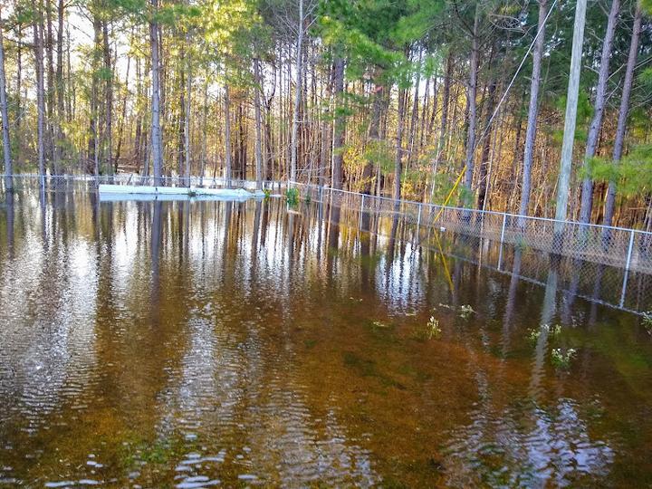 Photo Courtesy of Jacqueline Jones.
Our lab volunteered our time and expertise as part of AGU’s Thriving Earth Exchange which helps connect communities with resources and experts to address issues impacting their community. We worked to help a vulnerable community in Reidsville, Georgia with flood mapping.
Reidsville GA Community Floods, a small community group, seeks to prevent residential flooding in Reidsville, GA. This community science project will help residents understand their flood risks and the potential for green infrastructure as a step toward this greater goal. In parallel with the group’s existing partnerships that are investigating county-level flooding, the outcomes of this project are to 1) create a map that outlines flood risk in the community 2) better understand the potential for green infrastructure, including replicable green infrastructure on private property.
One of the final products of this project is a story map created so that the community can learn about flooding in their area and how we were able to measure and document the flooding using satellite imagery. Take a look here.
Social Media Buzz:
Can you imagine being worried about your home #flooding every time it rains?
— Dr. Mirela G. Tulbure 🛰 🌎 + 🐍 + 🌊 (@MirelaGTulbure) March 13, 2023
This was the worry of the Reidsville GA Community Floods group when they, supported by the @AnthropoceneAL partnered with my lab through @theAGU 's Thriving Earth Exchange program https://t.co/pZB0B2Vko2
Vini Perin
PhD Student
My research interests include surface water, agriculture, irrigation, remote sensing and hydrological modeling.
Mirela G. Tulbure
Professor
I am a Professor with the Center for Geospatial Analytics at North Carolina State University (NCSU).
Mollie D. Gaines
Postdoctoral Research Scholar
I am a Postdoctoral Research Scholar in the Department of Forestry and Environmental Resources at North Carolina State University.