Undergraduate Researcher Presents at NC State’s Research & Creativity Symposium
GAEC lab member Darcy Boast presented her undergraduate research last week.
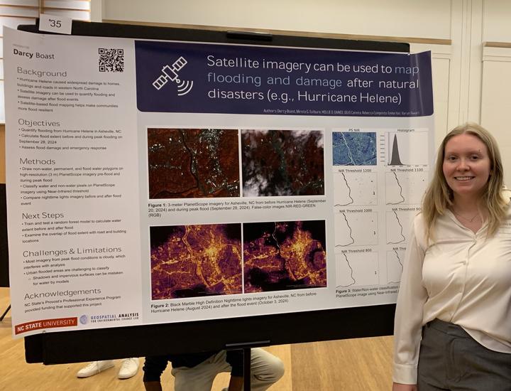
The ongoing project focuses on satellite imagery as a tool to assess the extent and damage of flooding after extreme weather events like Hurricane Helene. Darcy uses PlanetScope and NASA Black Marble Nighttime Lights to examine Asheville, NC, before and after Hurricane Helene.
The next steps for the project include calculating flood extent for the River Arts District of Asheville, NC, during the peak flood (September 28, 2024) and examining the overlap of flood extent with road and building locations.
This work is part of the GAEC lab’s ongoing effort to map flooding using satellite imagery and machine learning. Read the project abstract here.
Social Media Buzz:
Darcy Boast
She/Her/Hers
Undergraduate Researcher
I am an undergraduate student majoring in Environmental Sciences at North Carolina State University.