New Rice Mapping Methods For Addressing Food Security in Bangladesh
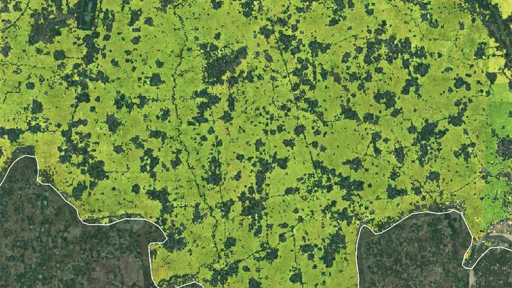 Satellite imagery of rice cultivation in Bangladesh provided by Varun Tiwari
PhD Candidate, Varun Tiwari’s work is currently being highlighted by NC State’s Center for Geospatial Analytics.
To learn more about the inspiration for his most recent paper ‘Automated in-season rice crop mapping using Sentinel time-series data and Google Earth Engine: A case study in climate-risk prone Bangladesh’ check out this blog post.
Brooke Cox
She/Her/Hers
Undergraduate Researcher
I am an undergraduate student majoring in Environmental Science at North Carolina State University.